
 LinkBack URL
 About LinkBacks


I ducked down the road this morning to a memorial for a couple of Spitfire Fighter pilots who died here during WW2. I'll include the maps I put in another thread in order to keep it all together and my photos below.
Tonight I'll go back and light paint the memorial and add those in this thread later.
This is a Story Board that tells what happened that day
These two are shots from each end of the memorial
This is a shot of the depression the Spitfire made, still evident after over 60 years and all the leaf litter etc that has gathered in it. That's my Tripod (Michaelaw and AntZ will recognize it easily as they have the same), a full sized Manfrotto but with the legs collapsed in. So the depression is probably only about 400mm ( around 1/2 a yard) deep now.
There are stories that the engine block is still in the bush behind this somewhere but I've never found it. Probably found and taken many years ago.
A closer shot of the Rock and Plaque
And finally the Plaque itself
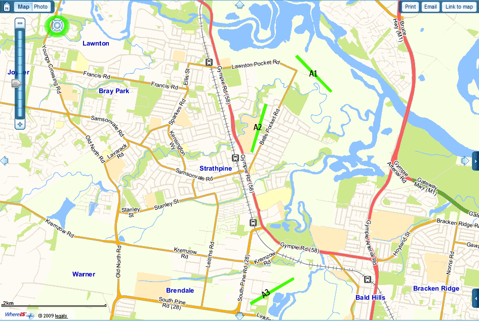
Here's a couple of maps to show the airfields that were here back in those days ... A1 is where these pilots took off from that day in April 1944.
This is off some guys website ozatwar.com, a fella called Peter Dunn
This a modern map of the area. In the top left hand corner is where I live. (Green circle and blue marker). The airfields are A1,2 and 3 where I put those green strips. A2 is now a suburban street ... Runway Street.
The crash site is just out of view on this map just above where I live.


 Reply With Quote

Bookmarks